Public & Private Land
A tappable map layer shades public land, parks, forests, WMAs, refuges, BLM and more, so you can spot open-access water at a glance and stay off private ground.
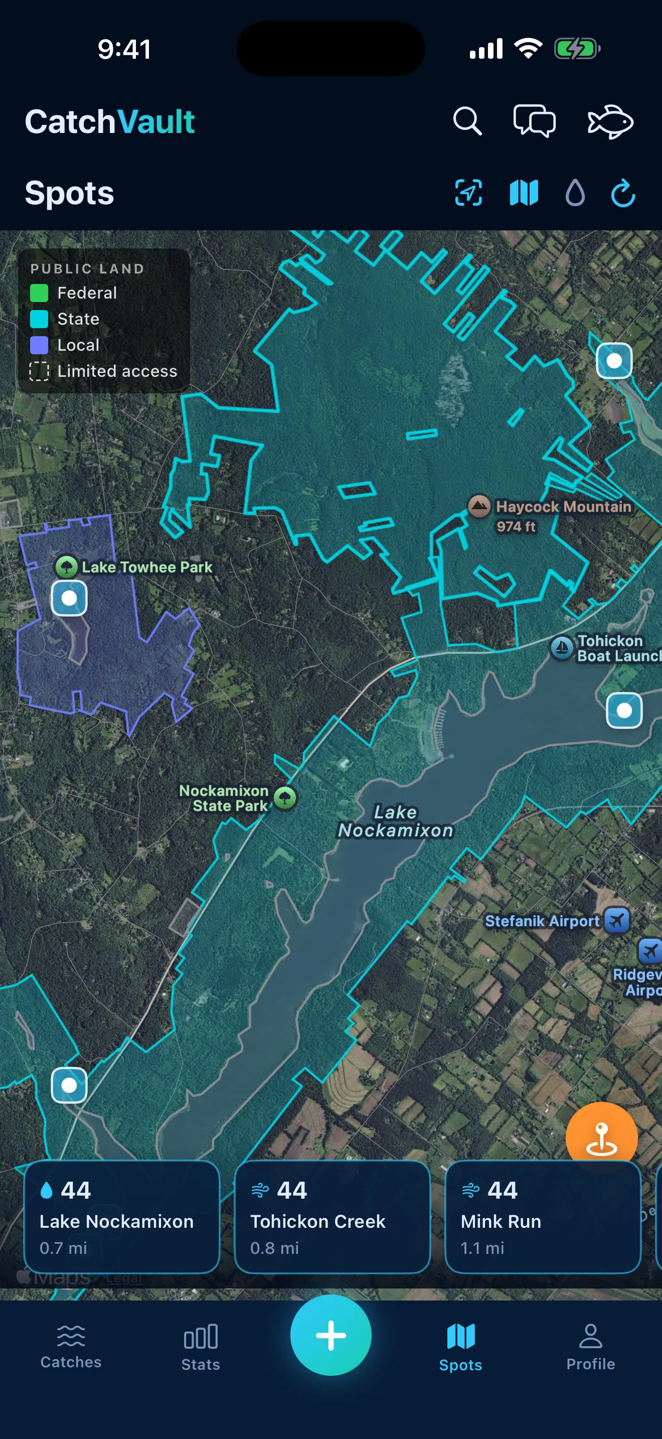
See public access at a glance
Toggle the land layer on the spots map and every public parcel lights up, national forests, state parks, wildlife management areas, refuges, BLM ground and more, so you know where you can fish.
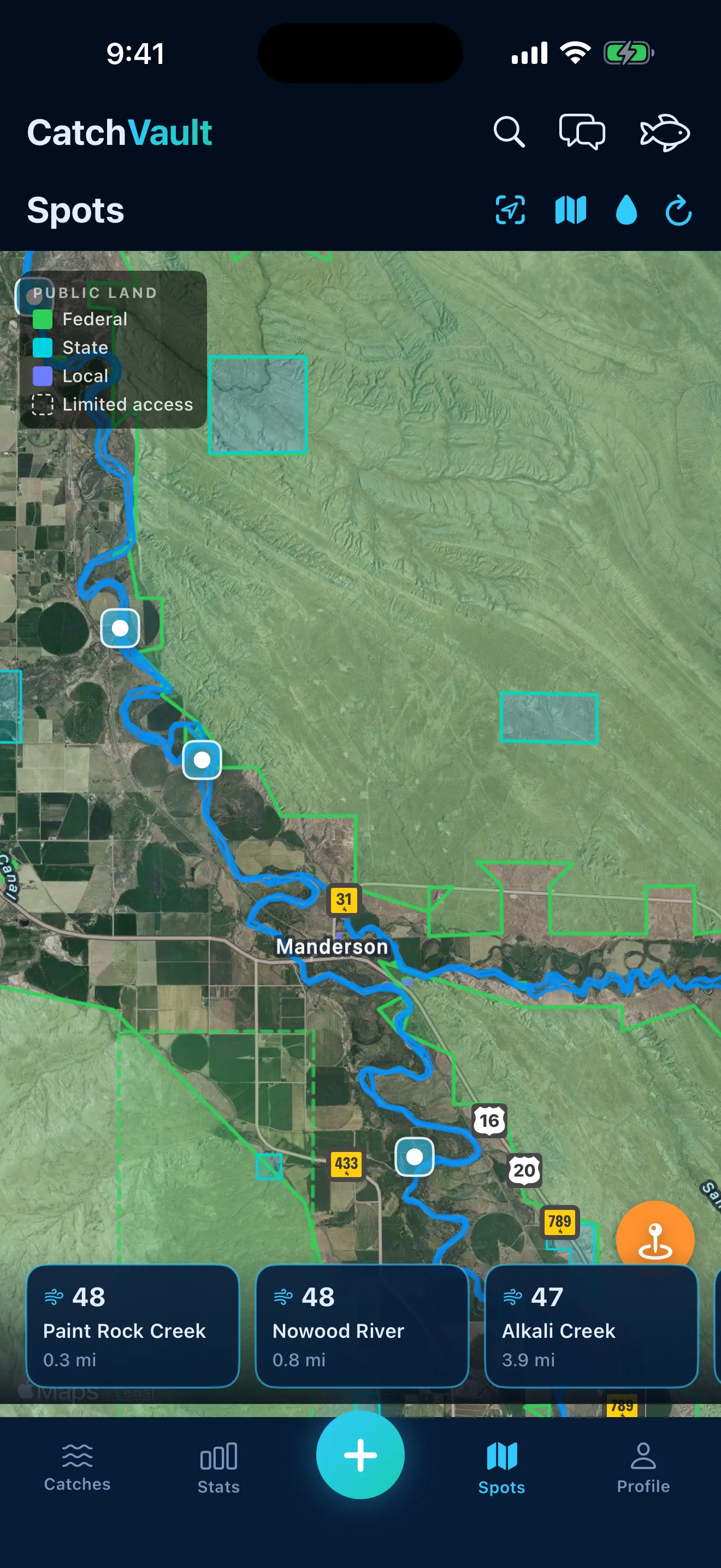
Color-coded by who manages it
Federal, state, and local lands each get their own color, and limited-access parcels are outlined with a dashed border, so you can read ownership and access at a glance.
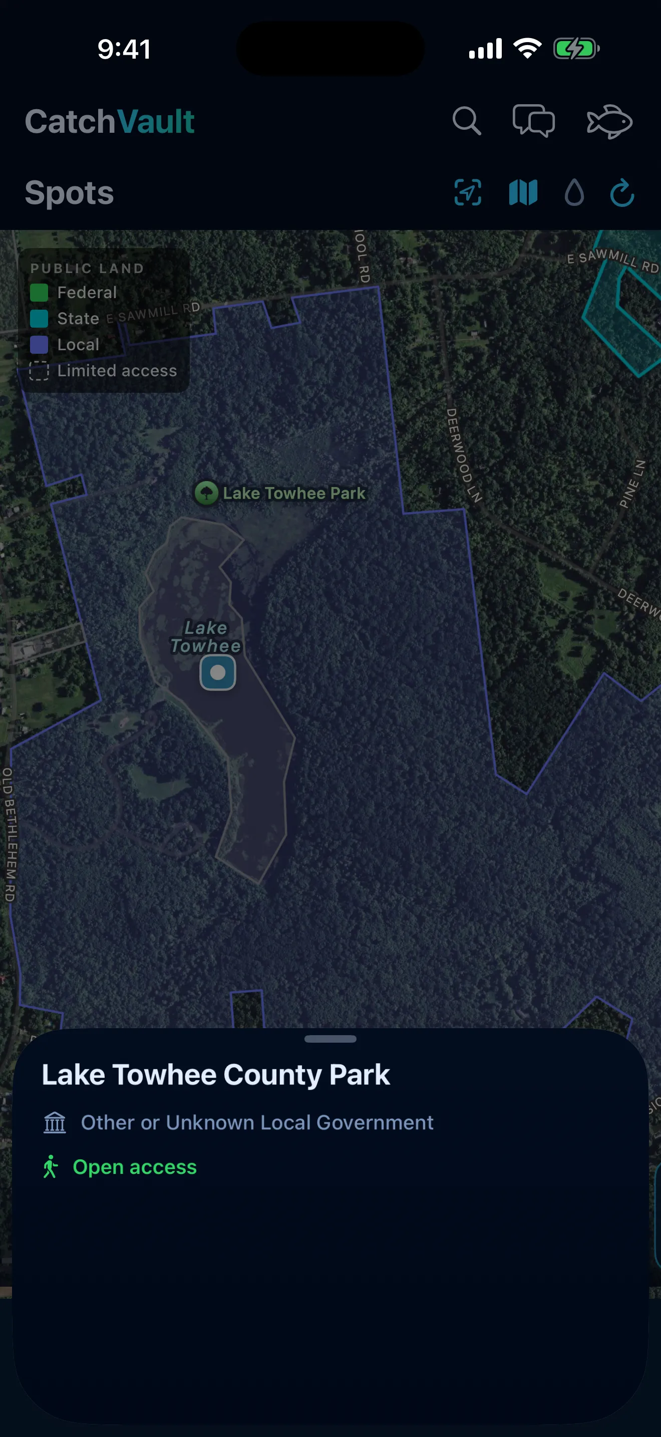
Tap for the details
Tap any shaded parcel for its name, managing agency, and access level. Everything unshaded is private, keeping you off posted ground and out of trouble.